
Alabama County Tax Maps/GIS Maps
(See below for Georgia, Tennessee, & Texas Tax Map Links)
 Alabama Department of Revenue – provides links to the Tax office in each county, along with an overall Alabama county map. Also, see the ADECA Flood Map Site. Please read below for more info:
- Autauga Tax Maps
- Baldwin Tax Maps – Records
- Barbour Tax Maps
- Bibb Tax Maps – Probate
- Blount Tax Maps – Records
- Bullock Tax Maps
- Butler Tax Maps
- Calhoun Tax Maps – Probate
- Chambers Tax Maps
- Cherokee Tax Maps
- Chilton Tax Maps – Records
- Choctaw Tax Maps – Probate
- Clarke Tax Maps – Probate
- Clay Tax Maps – Records – Probate
- Cleburne Tax Maps
- Coffee Tax Maps – Probate
- Colbert Tax Maps – Probate
- Conecuh Tax Maps
- Coosa Tax Maps – Probate
- Covington Tax Maps
- Crenshaw Tax Maps – Probate
- Cullman Tax Maps – Records – Probate
- Dale Tax Maps – Probate
- Dallas Tax Maps – Probate
- DeKalb Tax Maps – Records
- Elmore Tax Maps – Probate
- Escambia Tax Maps – Records
- Etowah Tax Maps – Records
- Fayette Tax Maps
- Franklin Tax Maps – Probate
- Geneva Tax Maps – Probate
- Greene Tax Maps
- Hale Tax Maps
- Henry Tax Maps – Probate
- Houston Tax Maps
- Jackson Tax Maps – Records
- Jefferson Tax Maps – Deeds
- Lamar Tax Maps
- Lauderdale Tax Maps – Probate
- Lawrence Tax Maps – Probate
- Lee Tax Maps – Records
- Limestone Tax Maps – Tax Info – Probate
- Lowndes Tax Maps
- Macon Tax Maps
- Madison Tax Maps – Probate – Land Books – Records
- Marengo Tax Maps
- Marion Tax Maps
- Marshall Tax Maps – Records
- Mobile Tax Maps – Probate – City of Mobile GIS
- Monroe Tax Maps – Probate
- Montgomery Tax Maps – Records – City GIS
- Morgan Tax Maps – Probate
- Perry Tax Maps – Probate
- Pickens Tax Maps – Probate
- Pike Tax Maps
- Randolph Tax Maps – Probate
- Russell Tax Maps
- Shelby Tax Maps – Probate – Topo Maps
- St. Clair Tax Maps – Records
- Sumter Tax Maps – Probate
- Talladega Tax Maps – Probate
- Tallapoosa Tax Maps
- Tuscaloosa Tax Maps – Probate
- Walker Tax Maps
- Washington Tax Maps – Probate
- Wilcox Tax Maps – Probate
- Winston Tax Maps – Probate
 Florida Land Boundary Info System (LABINS) – provides land surveying related info (records, aerial images, control, mapping.) See Florida Counties and the Florida DOR for links, FDOT for aerial images, and MyFlorida.
- Bay County – Panama City – PC Beach
- Duval County – Jacksonville – Records
- Escambia County – Pensacola
- Pinellas County – Tampa – St Petersburg – Clearwater
 Georgia Tax Maps Site – provides links to County Tax/GIS maps in Georgia. The Georgia Clerks Authority for deeds.
Illinois: – Cook County,
Massachusetts GIS – statewide GIS.
Mississippi GIS – Data & Maps – MARIS
New York State Parcels – list of all counties in NY state.
North Carolina County GIS Maps – NCOne Map
Oklahoma GIS Maps
South Carolina SCIWAY – GIS Maps – Aerial Images
Tennessee Tax Maps Site – provides tax maps for most counties in Tennessee. See CourthouseDirect or TitleSearcher for deed search.
The following Tennessee counties are not available on the above State site but can be found on their own internet sites:
- Bradley
- Davidson (Nashville)
- Hamilton (Chattanooga)
- Hickman
- Knox (Knoxville) – Deeds
- Montgomery
- Roane
- Rutherford(Murfreesboro)
- Sevier
- Shelby (Memphis)
- Sumner
- Unicoi
- Williamson
Texas County CAD List – provides links to County Central Appraisal Districts in Texas. See Texas File for records, also TX GLO.
Wyoming Parcels Viewer – Tax/GIS maps for all WY counties
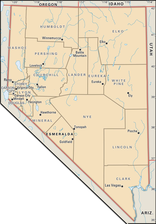
UTAH:
- Clark County Tax GIS
- Washoe County Tax GIS
- Lyon County Tax GIS
- Carson City GIS
- Nye County Tax GIS – County Code
- Elko County Tax GIS
- Douglas County GIS
- Churchill County GIS
- Humboldt County
- White Pine County
- Pershing County
- Lander County
- Mineral County
- Lincoln County
- Storey County ‘
- Eureka County
- Esmeralda County
Other Links:
NOAA Digital Coast: Provides LiDAR data for coastal regions of the United States.
The National Map (TNM): A collaborative effort offering various geospatial datasets, including LiDAR data for USA
FEMA Map Service Center: Looking for the flood map at your address? – eLOMA Portal: To get your LOMA done.
AirMap: for drone mission planning.